
 Français
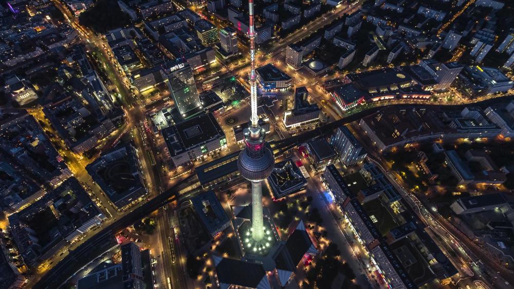 Aerial View Of Berlin, Germany, Mitte - Video By Drone - © FilmRaw/HOsiHO
The advantages of urban aerial videos
Changing your point of view is sometimes necessary to grasp the full splendor of a spectacle. This is precisely the observation we make with the art of urban aerial photography. This practice offers, compared to traditional photography, a unique perspective which reveals before our dazzled eyes the hidden beauty of urban landscapes.
Why are we passionate about these aerial images?
It should be noted that although aerial video is technically demanding, it highlights aspects of our urban environment that are generally ignored. This is why aerial images offer a unique experience, they overwhelm our vision and blossom our sense of beauty, indisputable proof of the visual magic of urban planning seen from the sky.
The visual impact of urban aerial images
Have you ever contemplated the beauty of a metropolis from the air? The aerial angle offers a renewed vision of the cited, highlighting sometimes unsuspected characteristics .
The aerial perspective: an astonishing configuration
One of the wonders of aerial photography is the perspective it offers. From afar, our gaze becomes omniscient, embracing the city as a whole. These images present configurations ordinarily invisible to the human eye and provide a panoramic vision which significantly modifies our perception. Indeed, on the ground, we cannot appreciate the entire urban composition of our cities, while they unfold in their full splendor from the air.
Highlighting architectural details
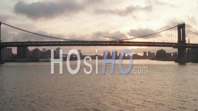
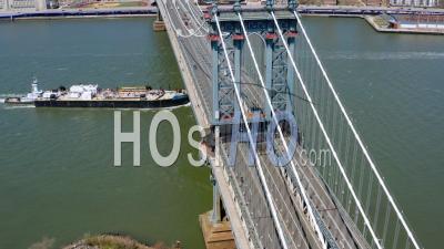
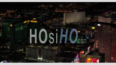
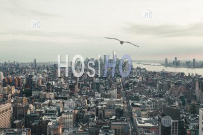
While aerial photography offers an overview, it is also capable of isolating architectural details to highlight them. A National Geographic study in 2018 showed how this approach makes it possible to enhance the architectural diversity of urban landscapes. By flying over a city, we become able to grasp the finesse of architectural designs, to appreciate the richness of urban morphology, with curves, lines and masses that intertwine to give birth to a canvas of urban art. And what better way to illustrate it than these aerial videos of New York?
-
 4k
4k -
 4k
4k -
 4k
4k -
 4k
4k -
 4k
4k -
 HD
HD -
-
 4k
4k -
 4k
4k -
 4k
4k -
 4k
4k -
 4k
4k
Capturing urban movement
Finally, the aerial image makes it possible to capture movement and urban activity. In fact, the incessant movements which characterize our cities create a dynamic, a continuous flow of life and energy which becomes palpable through the lens. Thus, from the air, we can observe the ballet of vehicles on the roads, the comings and goings of pedestrians on the sidewalks, the surprising play of shadows and lights... More than a simple static shot, the video urban aerial transforms into a true testimony to the continuous movement of the city.
In this way, the visual experience of urban aerial images reveals the depth and complexity of the city, a living mosaic that continually gains in richness and diversity.
The diversity of urban landscapes in aerial images
The contrast of urban neighborhoods
Each city hides a rich array of landscapes, subtle or fagrant. In aerial images, the distinction between residential and business districts seems striking. The apartment buildings, aligned like a game of dominoes, form a mosaic of roofs in shimmering and varied colors. In opposition, the activity zones rise towards the sky, offering a skyline made entirely of glass and steel, breaking out the horizon. The differences in colors, shapes, shadows and lights create a dynamic and eclectic urban map.
Greenery as a backdrop
In this aerial ballet, the buildings and streets are covered in greenery. We then observe urban parks, real oases of freshness in the heart of the city. They form spots of intense color, contrasting with the concrete of the surrounding neighborhoods. These expanses of greenery provide necessary breathing space in the middle of concrete, a visual respite in the race for development.
The leading figures of the metropolises
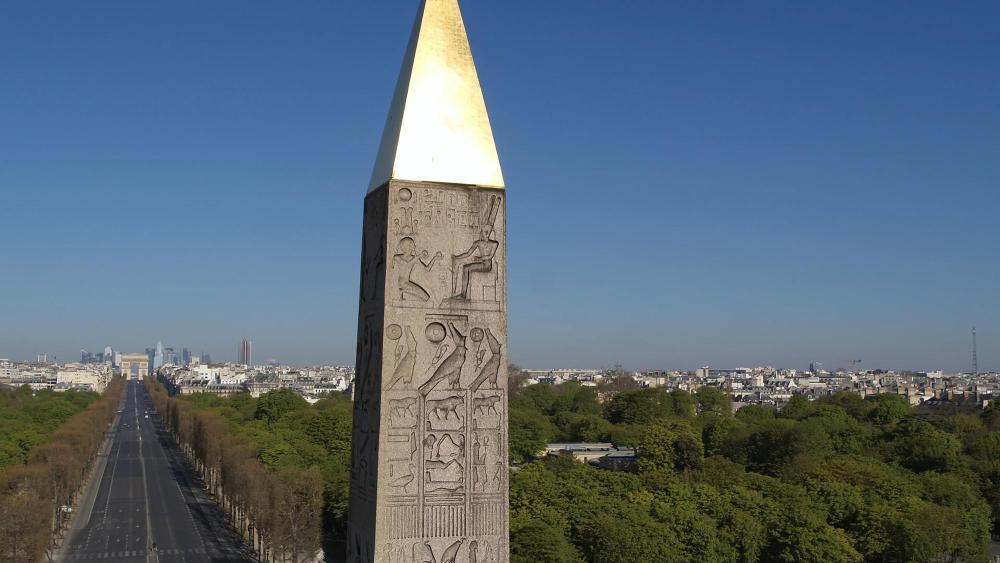
Metropolises around the world are known for their emblematic monuments: Paris with the Eifel Tower, London with its Big Ben, New York with the Statue of Liberty, Marseille with Notre-Dame de la Garde, ... These figureheads are easily distinguished in an aerial view, adding a layer of historical and cultural richness to the city. Their exceptional dimension becomes even more visible from the skies, while they are written in capital letters in the urban text.
The harmony of architectural styles
Finally, the architectural harmony of a city reveals its soul and its complexity. The contrasts between old and modern buildings, between wide streets and narrow streets, create a diverse urban panorama. Each era has left its mark, each district has its own identity and style. In aerial images, these traces become lines, shapes, colors that overlap and complement each other, forming an extraordinary urban composition.
Applications of urban aerial images
The underside of advertising: The use of aerial images
We are surrounded by aerial images without even realizing it. These photos enhance advertising and marketing projects. Without these images, would they be as captivating? They offer an impressive panorama, revealing rooftops and urban parks, thus contributing to a unique visual presentation of products or services. The bird's eye view of the road network also helps to highlight the accessibility and attractiveness of a given location.
Urban planning: A trigger thanks to aerial images?
Who would have imagined that aerial photography would have a major role in urban planning ? In fact, it offers us a global vision of the urban landscape, allowing a better assessment of needs in terms of construction and development. It is a valuable resource for:
Documentation of the works: Between aerial images and construction
To get a complete and detailed overview of the evolution of a construction project, nothing better than aerial photography by drone. Whether performing regular flyovers to document construction progress or capturing impressive images for project presentations, aerial imagery plays a crucial role in this industry.
Urban tourism: A business of aerial images
Before traveling, who has never studied aerial images of their future destination to familiarize themselves with the geographical setting? Tourism benefits greatly from aerial photography, which provides an immersive view of a city and its key attractions (museums, parks, monuments, etc.). These images not only allow you to plan a trip, but also to promote destinations.
When art and aerial images meet
Art knows no limits and aerial images are the perfect outlet. With an aerial view, urban rooftops, parks and road networks take on a distinct painterly appearance, creating unique graphic compositions and works of art. Thus, these new and disconcerting perspectives are a source of inspiration for artists, bringing new dimensions to their creativity.
Images of confined cities filmed by drone
Have you ever contemplated the urban landscape of a city in confinement from the unique angle of a drone? When a city is lockdowned and enters quarantine, its landscape changes completely, its usual dynamism giving way to an unexpected tranquility.
The sidewalks are empty of their usual passers-by, the cafes close their doors and the cars disappear from our roads. The large boulevards teeming with activity are transformed into silent trails. The buildings that usually define the urban profile lose their primary meaning; they are no longer just a place of work or residence, but also become the balustrades of an unusual silence.
Aerial images captured by drones during these periods of confinement present a spectacle that is both disturbing and fascinating. The noise and hustle and bustle of the city give way to an impressive calm and astonishing serenity.
But this change in perspective also offers a new appreciation for urban art. Murals, sculptures and other architectural details that often go unnoticed in the daily hustle and bustle become the undisputed protagonists of our environment.
These vast panoramas deserted by humanity then reveal their full aesthetic potential. The empty streets, punctuated by flashing traffic lights and the buildings lit only by their own lights form almost dreamlike scenes.
Through the lens of a drone, we see clearly that our urban environments are much more than just concrete or glass structures. They have an existence of their own, a life that persists even when their inhabitants temporarily disappear. Such a vision reorients our view of the urban by revealing it from the angle of hidden beauty, and pushes us to think about the place we occupy there.
To see the historical images of cities confined in 2020/2021 filmed by our authors' drones, we invite you to discover our specific gallery on this subject by following this link: https://www.hosiho.com/en/gallery/48/covid-lockdown